Visits to Hwangsan sites: On 11 November 2001, Kalani O'Sullivan and his daughter, Boram, visited the location of the old site. After many false starts they finally got instructions from a policeman who knew how to get to the temple area at a police box just outside Kimje. It was plain blind luck that they found this particular policeman as other people in Kimje -- including the Kimje Police Liaison -- knew nothing of the location. Following the policeman's instructions using Route 23, it was relatively easy to get to the area as the roads were all four-lane or straight-away two lane roads.
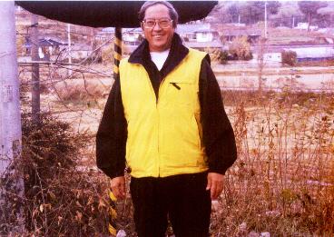 Kalani O'Sullivan at old Launcher Site Gate (Click on photo to enlarge) Go to Mini-profile of Kalani Because the visit failed to find the correct locations of the unit, Hwangsan was revisited on 17 November 2001. This time, Kalani took along his wife and daughter. A lot of information was garnered during this visit and now it appears that a lot of misconceptions of the site being abandoned have been proven wrong. In addition, it was found that the ROK Air Force had assumed command of the camp from the ROK Army...and the Nike Hercules functions are now under the ROKAF "Air Defense Artillery Command". (SITE NOTE: In July 2006, the ROK Ministry of Defense stated that they will again reinstitute the Air Defense Artillery function under the ROK Army as there are plans for the SAM-X project to replace the aged and malfunctioning Nike systems. The ROK started in 2003 to negotiate for used PAC-2 missile batteries from Germany, but as of 2006 none had procured -- as the USFK has PAC-3 batteries at Suwon, Osan, Kunsan and Kwangju. In addition, there are the Army ATACMS multiple-launcher systems in place to respond to artillery response in case the North should attack.) 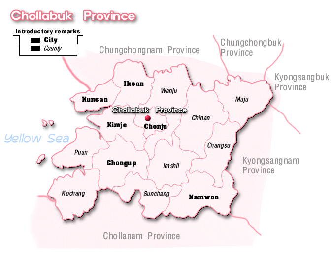 Chollabuk Province From Kimje Internet Click on Map to Enlarge 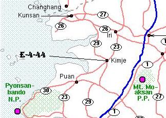 Location of Camp Echo Hill (E/2/44) There are two routes to the site. The first is driving from Kunsan -- which has the International Airport -- on Route 26 towards Iksan. Famed for its cherry blossoms in spring, this road has been a main traffic route connecting the City of Keunsan and the City of Chunju since it became a four-lane expressway in 1975.
At Taeya, turn right onto Route 29. This will use country roads to get to Kimje City, but the roads are very well-marked in English. Kimje is a medium-sized town by American standards with a population of about 123,000. One will pass through Kimje from the west and have to drive through the city to get to the railway station on the west side. The road signs are in English, but at critical points the English translations are missing (though Korean directions are written). A warning to those not used to driving in Korea. If you get off the main road, try to get back on it immediately. Korean side streets do not follow the geometric grid patterns of the U.S., but rather flow with the lay of the land.
 Kimje City From Kimje Sightseeing Guide Click on Map to Enlarge
A second method is to drive to Iksan from Kunsan using Route 26. At Iksan, you make a right at a "T" intersection onto Route 23. The route is very simple to use. However, it is NOT recommended unless, you know exactly where you are going and are used to the Korean interchange traffic patterns. The route has unmarked turns and only refers to "Hwangsan" in English on only one sign. Though by far the easiest method to get to the site, this route is not recommended for those NOT used to driving in Korea.
ROK AIR FORCE 8220-5 SITEROKAF 8220-5 Site: On the subsequent visit of Kalani to Kimje, it was learned that old IFC, Admin area, and Launcher sites were occupied by the RoK Air Force (ROKAF) 8220-5 unit of the Air Defense Artillery Command. Their mission is the continuation of the Nike Hercules missile defense. The ROKAF assumed command in 1991 from the ROK Army and would be the lineal descendants of the ROK unit that took over Nike Hercules Battery in April 1977.The Air Defense Artillery Command is under the Operations Command -- along with the Aircraft Control & Warning Wing and nine tactical fighter wings. According to RoK Defense Chronology, on July 1, 1991 the army's air defense artillery was transferred to the air force. The air force's Air Defense Artillery Command was established. (NOTE: On the 2000 Organizational Chart below, the command is listed as the "Anti-Aircraft Artillery Command.")
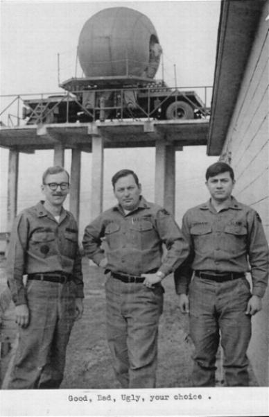
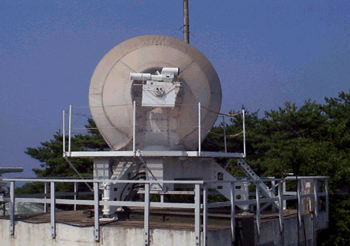
 ROKAF Organizational Chart From Chapter 1 Global Security Situation Click on Chart to Enlarge 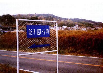 Sign for the ROKAF 8220-5 Site The following photo is from the Agency for Defense Development. It shows the NIDIR or NIke-hercules Digital Instrumentation Radar. The unit is the AN/TPQ-39(V), NIDIR manufactured by RCA in 1978 and upgraded by Korea. A unit similar to this was observed just above Moon-soo-sa Temple on the old IFC site.
 NIDIR According to a rumor from one of the residents of the village near the camp, the camp will be closed in the near future. This would be in line with the announcement in Sept 2000 that the Korean government was seeking to replace their two aging Nike Hercules battalions with Patriot PAC-3 missile systems along with other missile systems. The following is an excerpt from Asian Aerospace 2000 detailing Korea's needs in an article, "Asia-Pacific Economic Recovery Speeds Arms Procurement Revival" by John Fricker:
In recent times, there has been a push to build more modern facilities for the soldiers and upgrade their military hardware. Now that Korea has joined the G-12 and become one of the four dragons of Asia, it can afford to do this. In the Sept 2000 Report to Congress on the Military Situation on the Korean Peninsula, it stated that the Korean government was going to procure the Patriot PAC-3 Missile systems to replace its two aging Nike Hercules battalions.
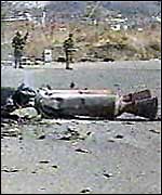
The following is an article in the BBC News on 20 December 2001.
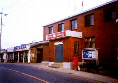
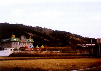
HWANGSAN TOWN Hwangsan Town Sign at the Town Office "Kimje Shi (City) Hwangsan Myon (Town) Imnida (Come)
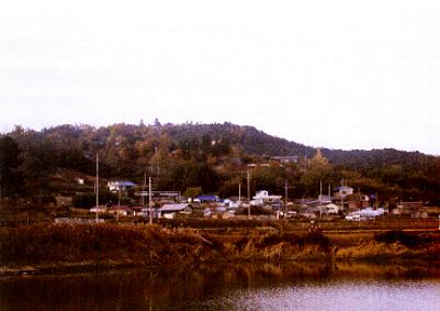
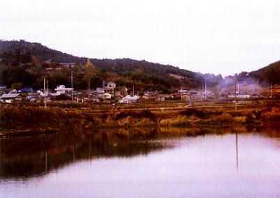
Hwangsan Town: The town of Hwangsan is typical of small country towns and is tidy-looking -- not run-down. In the center of the village is a post office and a middle school along with small shops. The streets are clean and the two lane road passes through the center of the town. Most of the shops are of the old-style small building construction. The only newer buildings appear to be the elementary school and government offices. The farmers' small tile-roofed homes are clustered behind the shops fronting the main street.
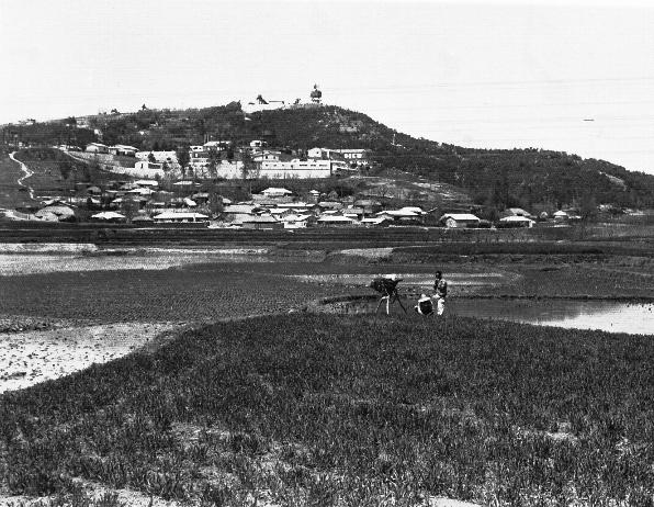
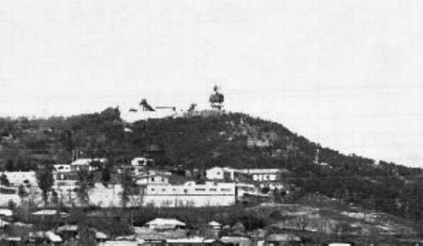
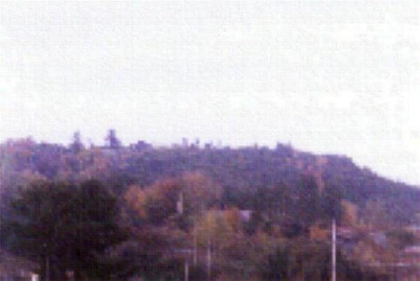
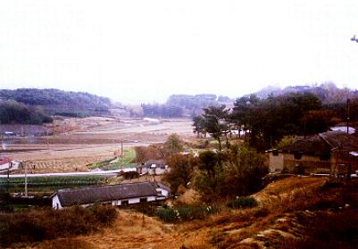
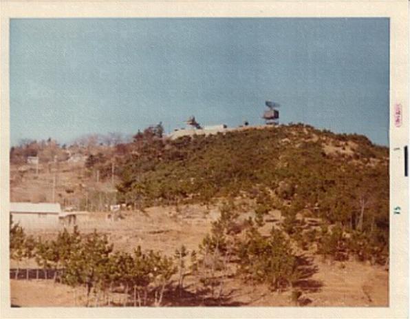
View of old IFC site from the town: Right behind the village is the IFC hill. The hill itself is densely covered in various types of trees. Ken had mentioned that the site was abandoned, but it is definitely occupied by a military unit as antennas are visible from below. Though the trees concealed most of the site from the bottom, the site does not appear to be very large. (It would be approximately the same space as the John Crawford's IFC photo.) The site is used by the ROK Air Force 8220-5 unit which uses the IFC area, the old Admin area and the old Launcher site.
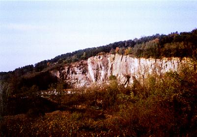
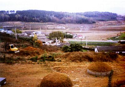
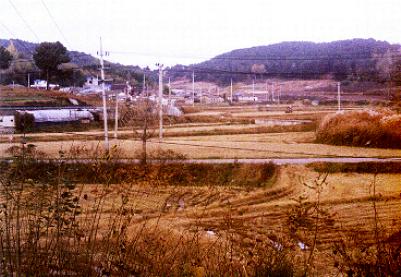
Roads to old IFC site and Moon-soo-sa Temple (Munsu-sa): The road up the hill was on the opposite side. The limestone quarry scars are readily visible from the main road. Unlike the photos of the quarry being totally void of trees, the trees now are right up to the edge of the quarry. The photo of the quarry shows a pre-school along the road to the village. 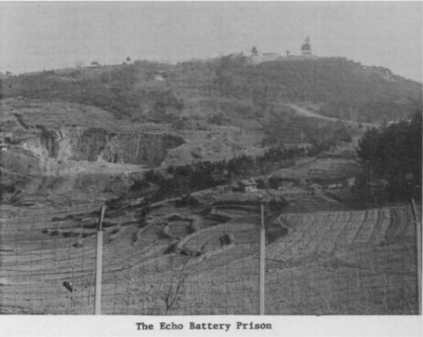 Quarry view From E Battery Yearbook (1975) (Click on photo to enlarge) (Courtesy Ken Wisz)
(Courtesy Kalani O'Sullivan)
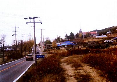
On the right hand side of the road is a large sign stating "Moon Soo-sa Temple" and extolling its 1,000 year history. You turn left onto a narrow concrete farm road.
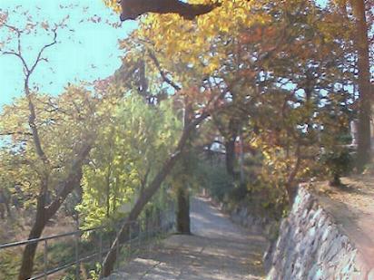
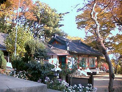
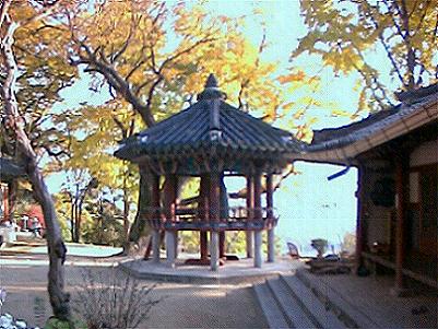
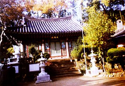
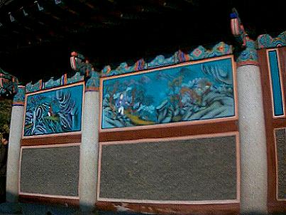
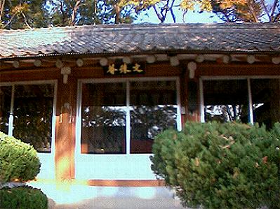
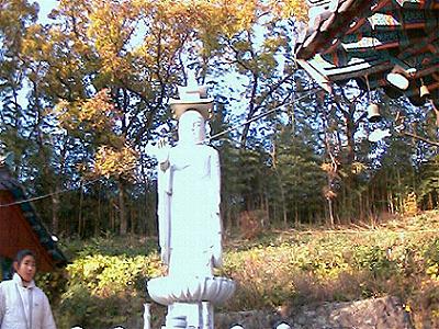
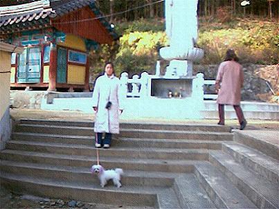
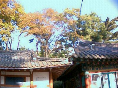
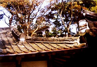
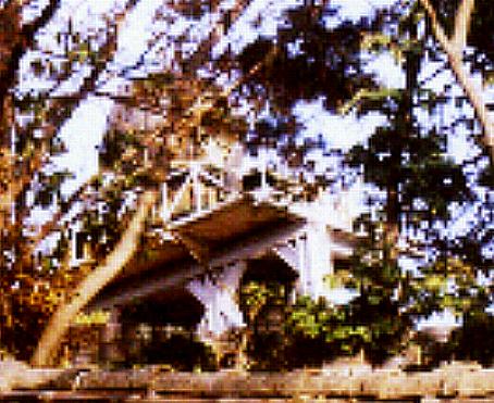
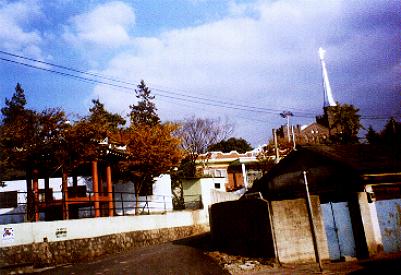
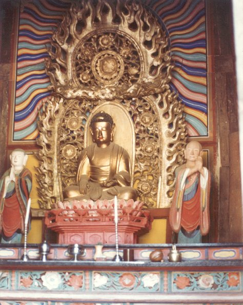
MOON-SOO-SA TEMPLEAt the top of the 20 degree incline road there is the Moon-soo-sa Temple (Munsu Temple). A small parking area is on the right. It is a short walk up a concrete path to the temple. The first thing one passes is a pagoda on to the left. Right above this there appears to be the living quarters for the monks. To the right there was the typical "open hole" toilet on the side of the path (with a hole big enough to fall in) -- a typical scene for mountain temples.On the next level is the main courtyard. In the main yard there is a shelter with the large bell and to the rear there is a large white standing buddha with its back against the hill. There is one large building beside it -- that houses a wooden buddha -- and two smaller buildings nearer the entrance path. The smaller two are for Buddha images and for use as a meditation hall. The restoration work is excellent. The restoration work appears to have been done in the 1990s and this site upgraded for tourism. Attention to detail is evident. The dragon head decorations extending from the smaller buildings have whiskers. One of the smaller buildings with the Buddha images has sliding glass doors to make viewing from outside possible. The other smaller building probably for meditation is equipped with air-conditioning. The walkways and steps are of recent construction -- within the past ten years. The viewing points to enjoy the scenic vistas have railings and concrete platforms.
Click on photos to enlarge (Courtesy Kalani O'Sullivan) The layout is very typical of the old-style Buddhist temples. In the setting of trees with a very nice view of the countryside, this is a very picturesque temple. The panoramic view over the surrounding area is very nice. 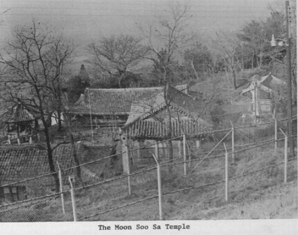 Moon-soo-sa Temple From E Battery Yearbook (1975) (Click on photo to enlarge) (Courtesy Ken Wisz) The picture of the temple in 1975 is about the same as it is today. In the photo, you can see the pagoda that's mentioned between the trees. The building shelter to the far left houses the bell. The far right building is the meeting hall. The building in the foreground is one of two buildings mentioned. Besides a few coats of paint, a different Buddha statue and some concrete work on the path, it has not changed much. 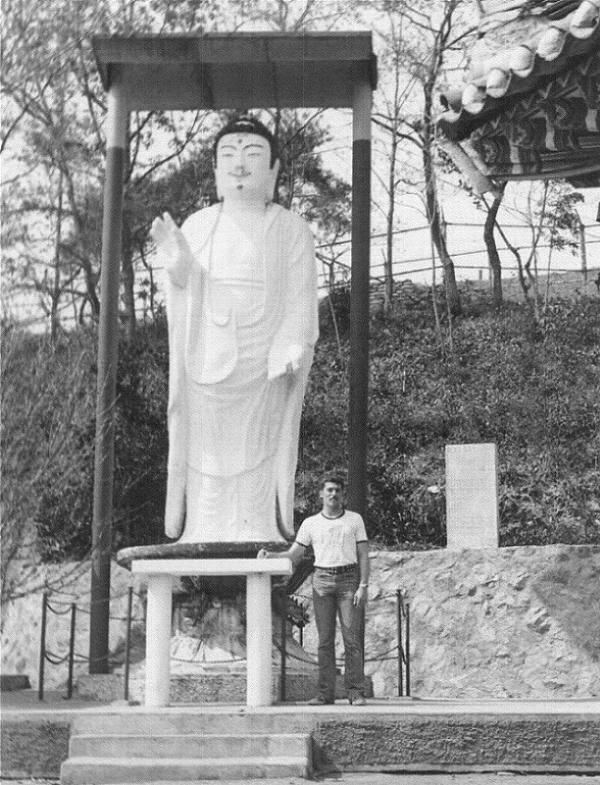 PFC Vetter at temple Note IFC fence in bkgnd (1975) (Click on photo to enlarge) (Courtesy Ken Wisz)
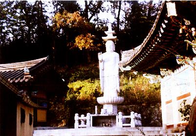
The Buddha statue is in the same location against the hill behind the far right building. However, the Buddha statue and base has been changed. The old statue's face had a mustache. The new one has a peaked hat and no moustache. The statue was probably replaced during the late 1990s when the anti-Japanese fervor hit its peak. The peaked-hat buddhas are some of the oldest buddha images found in Korea BEFORE Buddhism was sent on to Japan through the Paekjae Buddhist monks (educated in China). This type of action is in keeping with Korea's ideas of "revisionist history." Items of history that offend are simply replaced.
 Buddha image in Temple (1973) (Click on photo to enlarge) (Courtesy Steven S. Holsclaw)
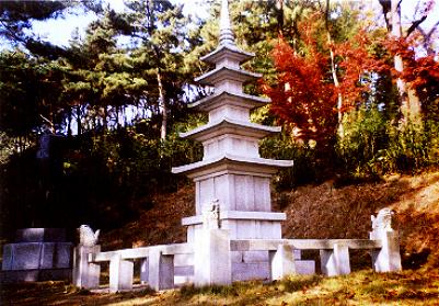
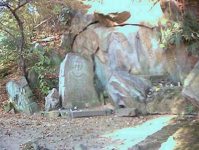
The second is a carved stone buddha that is found behind the buildings in a small alcove near the old IFC fenceline. Listed as the "Moonsoosa Mar-ae Yourae Jwasang" (sedentary statue), it is designated as the Tangible Cultural Asset No.175. Dating from the Koryo Dynasty, the sedentary statue in granite is an expression of Buddha on a lotus flower, which is a characteristic pattern.
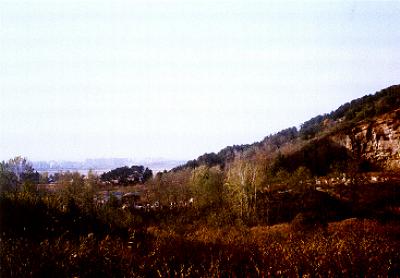
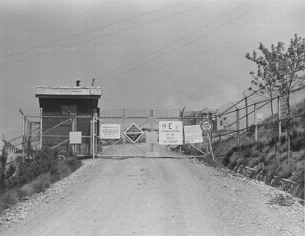
IFC SITEFrom Hwangsan Town, the antennas of the old IFC site can be observed. From the ground level, not much detail can be seen. There appears to be radio communications antennas on high poles. Only one radome could be seen and light poles surround the site. There appears to be a group of low buildings that cover a relatively small area. In John Crawford's photos of the IFC, the site would be approximately the same size.From the parking lot in front of the temple, the road leads to the old IFC site at the top of the hill. The road changes from a 20 degree slope to a 30 degree slope. On his initial visit, Kalani drove up this road until he hit the main gate. Kalani wrote, "Continued up this narrow road and was met by military guards with automatic weapons and a locked gate. Noticed the badge was ROKAF Security Police and another guard had the "Ranger" tab over his pocket. These type guards are for high-security areas." Entrance to the site is prohibited. In Korea, you get shot for pulling out a camera on a secure site. As there was no room to turn around, Kalani had to back down the hill to the juncture where the temple is. In reviewing the old 1975 photo of the IFC gate, Kalani is convinced that this is the old IFC gate. Everything is exactly the same -- including the 30 degree angle of the road -- except that now trees are on both sides of the road and the area is much greener-looking. The left side of the road has stacks of tires lining the length of the road all the way up to the gate. We assume that it is for winter driving when the concrete road would become slick with ice/snow and to prevent trucks from slipping off hill.
 IFC Gate Shack (1975) (Click on photo to enlarge) (Courtesy Ken Wisz) The close proximity of the IFC to the Moon-soo-sa Temple can be illustrated by radome and antenna that was photographed through the trees at the temple. The radome (antenna/electronics inside) was in the medium-size range. In addition, there appeared to be an external communications dish on the same platform with the radome. Its function is unknown.
Click on photos to enlarge (Courtesy Kalani O'Sullivan)
Click on photo to enlarge
Carl Woida, CW4 (Ret), Launch Officer 1971-72, commented on the radome, "It looks pretty much like a Nike missile site radar to me. On every Nike site there were 3 like it: a missile tracking radar (MTR), a target tracking radar (TTR), and a target ranging radar (TRR). All 3 look identical from a distance." Later Ken Wisz commented that it looked like the IFC site radomes on raised platforms. However, the platform was reinforced with diagnol cross-beams.
Click on photos to enlarge (Courtesy Ken Wisz)
In comparing the photos 1975 and 2001 Admin area and IFC site, there appears to be a similar radome and radar antenna on the IFC site for both time periods. Though less prominent in the 2001 photos, they are in about the same location -- directly above the Admin Area.
 IFC (1975)
Click on photo to enlarge (Courtesy Ken Wisz)
Click on photo to enlarge (Courtesy Kalani O'Sullivan)
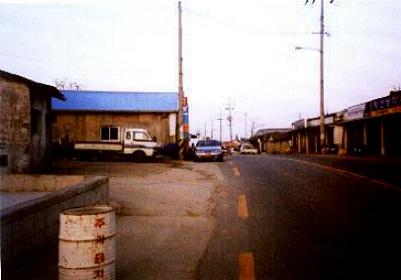
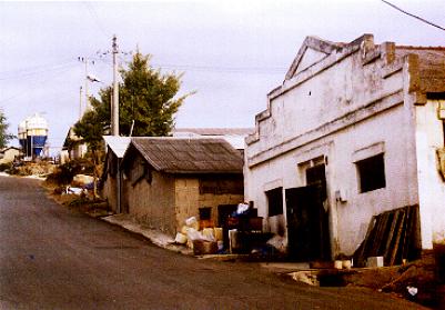
SAEMAUL VILLAGE AREAThe village area used to be known as "Saemaul" or "New Town." It is now a depressed area. The road is lined with small buildings and shops that are deserted and falling apart or shuttered and locked. The building fronts are unpainted and all structures have paint peeling off of them. Unlike Hwangsan Town, this village reminds us of a statement that appeared in Asia Business Week in the 1990s. It stated, "The Korean countryside is filled with only two things -- graves and old people waiting to get there." This is one of those places.Starting at the west end of the village, one passes the road that leads to the Moon-soo-sa Temple (Munsu-sa). To the left (north) is a long light-green painted wall behind which the tightly packed farmers homes are clustered. Behind the homes is the base of the hill. To the right (south) of the road are rice fields. After the wall, both sides are lined with small cubby-hole type shops that are typical in older towns or older sections of the Korean cities. Most are shuttered or abandoned.
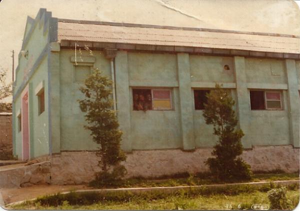
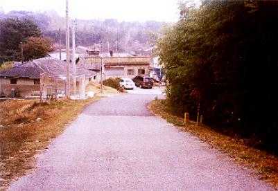
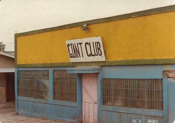 "Giant" Club (1975) The old "Giant" Club on the west side of the village is now a small church meeting hall. Behind the shops on the left (south) of the road, the base of the hill steeply rises. Behind the shops on the right, there are small "vinyl" greenhouses (metal half-hoops with vinyl stretched over them) in the elevated patches of ground for growing vegetables out of the elements. The rice fields are behind these.  Looking towards Launcher Site from Ville On the east end on the left . there is a traffic light on the intersection that blinks yellow with a blue sign pointing to the "ROKAF 8220-5 Camp." The road up the hill seems incongruous as it is larger than the normal country roads seen -- even for Korean military sites. This area was the former bar row for the Camp Echo Hill soldiers.
Click on the photo to enlarge (Courtesy Kalani O'Sullivan) The Old Bar Row: Once the American GIs departed, the economy of "Saemaul" (New Town) died. The bar girls -- mostly older women in their forties moved away -- and the bar owners closed their businesses. Any other businesses that supported the bars -- such as a beauty shop -- died as well.  Click on photo to enlarge (Courtesy Ken Wisz)
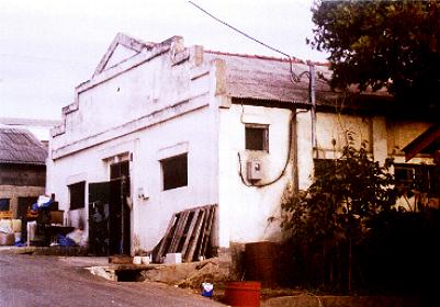
On the right corner of the old Admin Road is the "Ni Yong Shil" Beauty Shop which is now abandoned with the windows broken out and door collapsed. Only the faded painted lettering on small buildings shows that there was a business there before.
Click on the photo to enlarge (Courtesy Ken Wisz/Kalani O'Sullivan)
Below the old "Oasis UN Club" location, there is a rest pavilion. It is constructed to overlook the main road that passes through the village. There is a road behind the pavilion that winds its way to a church on a small hill. Behind the old "Oasis UN Club," there used to be "hootches" and old-style farmer homes built up on a small hill. Modern homes have been built in this area to replace the old farmers homes.
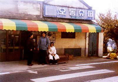
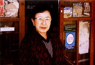
Click on the photo to enlarge (Courtesy Kalani O'Sullivan) Across the main road intersection at the old Admin area road is the "Odong Super" -- a tiny grocery store run by Mrs. Sao Soon-Hee. She has lived and worked in the village for 47 years. She lost her husband last year and said that in a year or two, she'll give away the store and retire. She now lives with her daughter in an apartment in Kimje. A soft-spoken lady, she was kind enough to tell us about the town and its occupants. She speaks no English. She sadly recollected that most of the people moved away to Seoul after the GIs left.
Click on the photo to enlarge (Courtesy Kalani O'Sullivan)
Above the entrance of the store is a tarpaulin canopy to keep the sun and rain from beating down. Outside the store is a raised square platform -- covered with vinyl floor matting -- for sitting and laying on during hot weather. The entrance to the store is the old wooden sliding door-type. The interior of the store is dark and one has to step down to enter. Some of the counter glass tops have been broken out and replaced by fencing wire. The shelves don't have much on them except for some sundry food condiments and house supplies. On the shelves are mostly snacks and soft drinks. Mrs. Sao said that though she lived there for many years, most GIs probably wouldn't known her name. Mrs. Sao Soon-Hee
Some of the people that Ken Wisz remembered -- such as Kim Ung Muk, the battery interpreter -- Mrs. Sao didn't know. It was possible that these people worked on the base, but commuted from Kimje. One must remember that most "interpreters" were college-educated individuals from upper-level families. Most would not live in country villages.
 Click on photo to enlarge (Courtesy Ken Wisz)
As for Paek Chung Chul, she didn't remember him as a "translator/interpreter" but rather as a street-wise little boy who would say "Hi" to GIs and get chocolate from them. Later he grew up to be a street hustler. After the GIs left, the village fell on hard times and the family moved away to Seoul. Park Chung Chul had some problems later on in life. Now in his fifties, he is still unmarried and lives in Seoul.
ADMIN AREAOld Admin Area: Heading up the hill, the old Admin Road passes around a bend to the left and there are bamboo thickets to the left on the hillside. To the right there is a view of the rice fields below. Below the shoulder of the road to the right, there are well-tended graves.The road makes a turn to the right and then meets up with the Main Gate of the ROKAF 8220-5 Camp. The road is much wider at this point than at the IFC site and a car can easily turn around. Of course, no pictures are allowed at these sites -- even of a main gate. It is rather strange that the road up to the bend where the military road takes over is paved. However, the military portion leading up to the Main Gate is covered with loose gravel that is tightly packed. As was said before, the ROKAF 8220-5 is thought to be the lineal descendant of Battery E of Camp Echo Hill. Though the camp and equipment was turned over in April 1977 to ROKAADCOM (Republic of Korea Air Aircraft Defense Command), somewhere in the past the Army function was shifted to the ROKAF. Currently under the ROKAF "Operations Command" organizational chart, the "Anti-Aircraft Artillery Command" is positioned. This means that the Nike Hercules is a ROKAF function. It is unknown when the transition to ROKAF control took place.
Click on the photo to enlarge (Courtesy Kalani O'Sullivan)
Judging from Ken's drawing of the Admin Area, the rear exit of the Admin Area is the road that joins the public access road below Moon-soo-sa Temple (Munsu-sa) that was noted before. It is unlikely that the Koreans built a new military road. The back gate road joins the Temple road and then continues on in a straight line to the IFC gate.
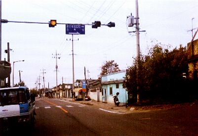
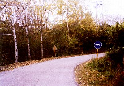
LAUNCHER SITEOld Launcher Site As one exits the "Saemaul" (New Town) heading east, one sees the rice fields to both the right and left of the road. There is a large irrigation pond on the left. Passing the bus stop to the left, there is a road to the right. There is a sign indicating the ROKAF 8220-5 Camp Site.The gate of the Launcher can be seen from the road. However, nothing else can be seen of the the old Launcher site as it is all obscured by trees.
 Click on photo to enlarge (Courtesy Kalani O'Sullivan) On his visit, Kalani stopped at the Launcher Site gate and spoke with the two ROKAF guards. Like the IFC site, they had the "Ranger" tab above their pockets along with the ROKAF Security Police badge. Kalani said, "The ROKAF Sergeants on guard would not permit any pictures of the site. However, I showed them my American military and Korean ID cards because in rank-conscious Korea, it helps to be a retired officer as well as a teacher. As such, they politely tried to answer what questions they could. Understanding their position on security, I asked only questions that were not security related. Unfortunately, they knew very little of the history of the area." Though they did not know much of the local area, they provided some leads to people with information on the area.
Click on the photo to enlarge (Courtesy Ken Wisz)
Click on the photo to enlarge (Courtesy Kalani O'Sullivan)
The guards stated that the current site was about the same approximate size and shape as the drawing Ken had done. From what had been seen so far from the exterior, there had been no changes to the area. It would therefore be a safe assumption that the interior of the site would still be quite similar to the map that Ken drew.
Return to Page 1
NOTICE/DISCLAIMER: The content of this page is unofficial and the views and opinions expressed do not necessarily reflect those of anyone associated with this page or any of those linked from this site. All opinions are those of the writer and are intended for entertainment purposes only. Links to other web pages are provided for convenience and do not, in any way, constitute an endorsement of the linked pages or any commercial or private issues or products presented there. None of this site has been endorsed by the DOD, the United States Army, the USFK, the Republic of Korea or Mickey Mouse. All links are publicly accessible through the world-wide web. If there is any discrepancy between eye-witness accounts and OFFICIAL DOD records, this site opts to lend credence to the eye-witness views.
|